


::
::
::
Helpful Links
Mail Delivery Subscriptions
Mail Delivery Outside Zone
Pay for Advertising/Sale Bills/
Print Jobs/ Other
Send a letter to the Editor
Subscribe or Renew Annual Subscriptions.
52 Issues.
Click the BUY NOW button to pay your bill.
Enter the dollar amount you were invoiced or quoted.
*COMMENTS/QUESTIONS:
Your video will be here
>> Sports Photos
Welcome to the Nebraska Journal-Leader

Copyright © 2011 Nebraska Journal-Leader. All Rights Reserved.
Subscribe or Renew In County or Contiguous County Annual Subscriptions.
52 Issues.
Credit Card users—
Click the don't have PayPal account Inside
Credit Card users—
Click the don't have PayPal account Inside
Credit Card users—
Click the don't have PayPal account Inside
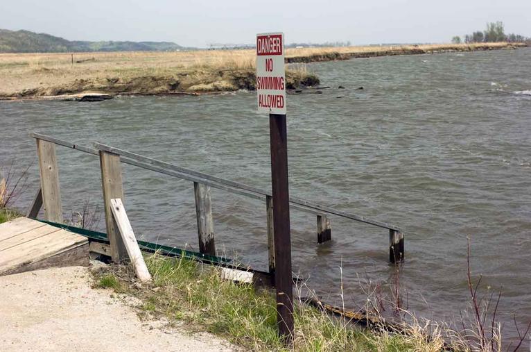
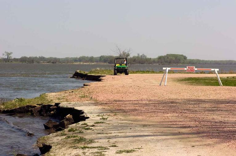
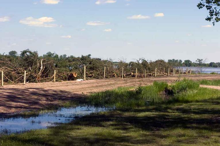
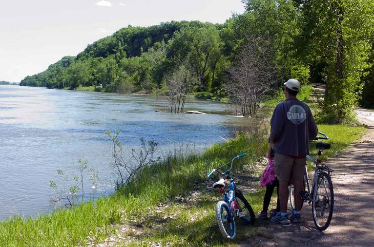
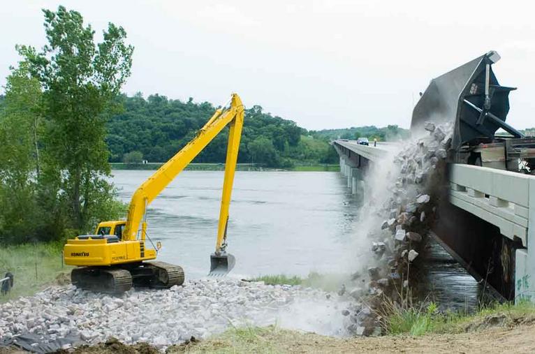


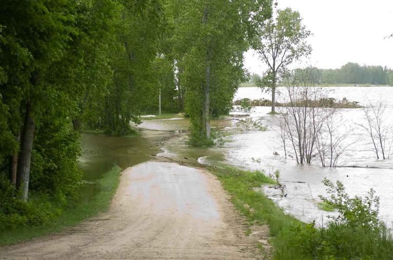
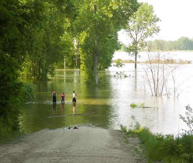
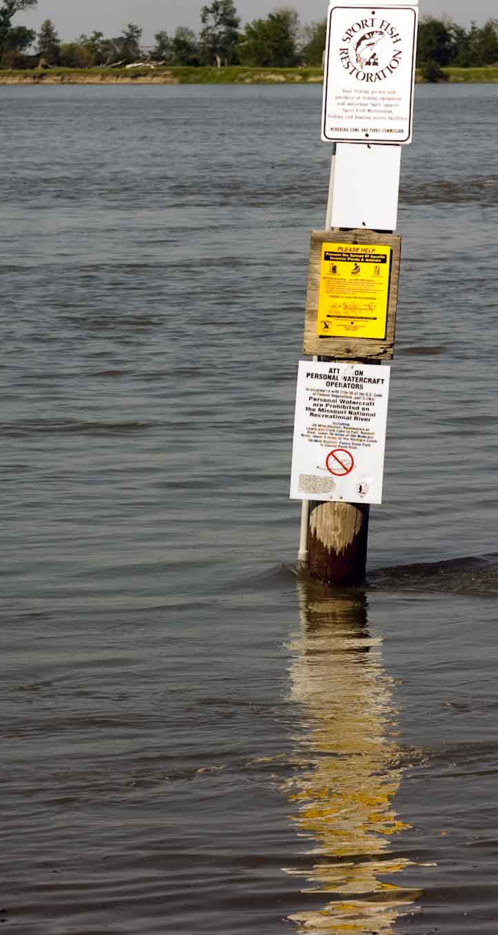
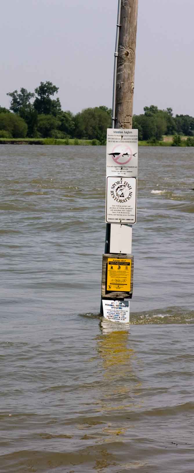
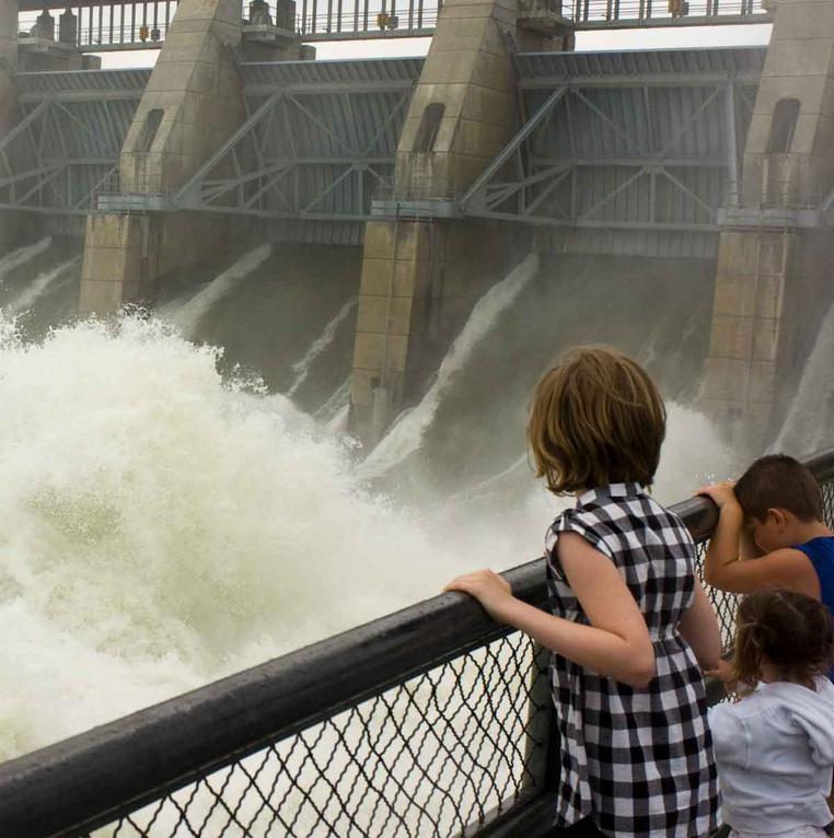
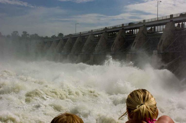
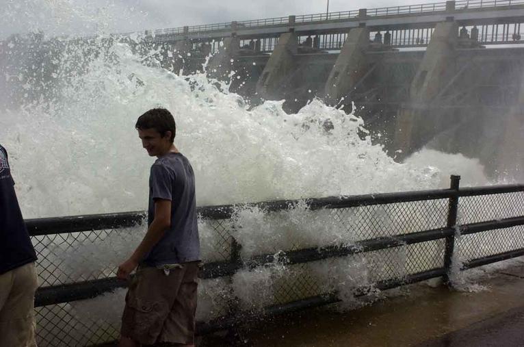
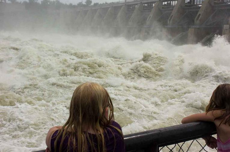
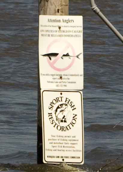
See Local Missouri River Flooding Photos Below
Click on the thumbnails to enlarge
We first realized that flooding was imminent when the waters began climbing the stairway that led down to the fishing bank. The pole at the boat ramp with the signs on it was our measuring stick to mark the advance of the water level begun at the same time the waters swamped the the park road. We recorded the trucks at the Newcastle-Vermillion bridge dumping rip rap rocks on the North side. Gavins Point Dam is a sight to behold for shear turbulence. Reportedly, the water there is rushing downstream at about 26 MPH. It customarily runs past Ponca State Park at 7-8 MPH, lately measured at 11 MPH. Only two signs remained above water on our measuring pole on June 27 2011 (last photo above).